

My Cart - items
items in your cart
Order summary
Total:
Grand Total:
*Shipping & taxes calculated at checkout
Featured Product: 2024 Yamaha FX HO
Featured Product: 2024 Yamaha FX HO

Garmin Marine


|
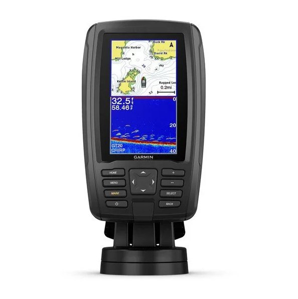
This compact combo has lots of built-in benefits. Easy-to-install and even easier to use, it has a bright screen 4.3” display that is easy to read on a sunny day on the water. It includes a GT20 transducer for traditional Garmin CHIRP sonar that delivers remarkable target separation and CHIRP ClearVü scanning sonar for nearly photographic images of what’s below the boat. ECHOMAP Plus 44cv comes preloaded with BlueChart g3 charts with integrated Navionics data, covering the coastal U.S. Plus, it has Quickdraw Contours mapping software to instantly create personalized fishing maps on-screen with 1’ contours as you fish. You own these maps. They are yours to keep private or share with the Quickdraw Community on Garmin Connect™. Plus, you can share waypoints and routes with other ECHOMAP or STRIKER units. It also features a quick-release mount allowing you to quickly install and remove your device from power and mount. Transom and trolling motor mounts included. |
| Dimension | 4.0" x 6.5" x 3.1" (10.2 x 16.5 x 7.9 cm) |
|---|---|
| Input | Keyed |
| Display Size | 2.1" x 3.7"; 4.3" diagonal (5.4 x 9.5 cm; 10.5 cm diagonal) |
| Display Resolution | 480 x 272 pixels |
| Display Type | QVGA, NP |
| Weight | 1.6 lbs (0.7 kg) |
| Waterproof |
IPX7 |
| Mounting Options | Bail or flush |
|
| Power Input | 9 to 18 Vdc |
|---|---|
| Typical current draw at 12 Vdc | 0.5 A |
| Maximum current draw at 12 Vdc | 2.0 A |
| Maximum power usage at 10 Vdc | 5W |
| Accepts Data Cards |
1 microSD card; 32 GB maximum card size |
|---|---|
| Waypoints |
5000 |
| Track points | 50,000 |
| Tracks | 50 saved tracks |
| Navigation Routes | 100 |
| Power output | 500 W |
|---|---|
| Traditional sonar (dual frequency/beam) | built-in (single channel CHIRP, 70/83/200 kHz, L, M, H CHIRP) |
| ClearVü | built-in 260/455/800 kHz |
|
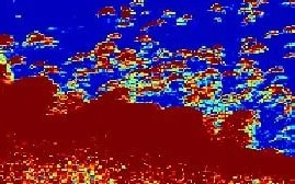
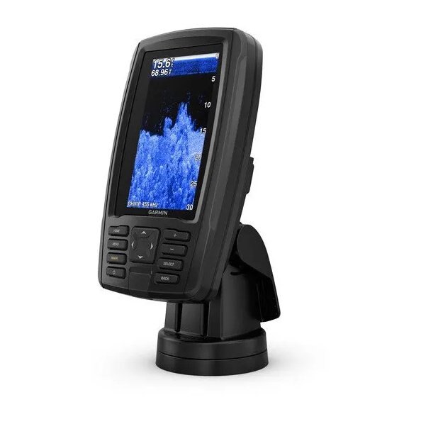
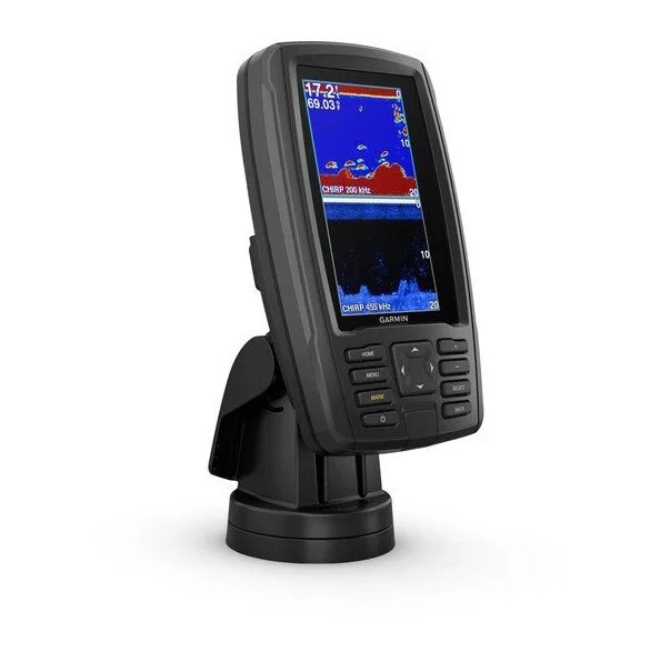
The built-in sonar capabilities of ECHOMAP Plus 44cv include our CHIRP traditional sonar, one of the most sophisticated sonar technologies available for the fishing and boating public. CHIRP traditional sonar provides amazingly clear target separation and definition, because it puts even more energy onto the target than traditional sonar. It also provides traditional sonar support for Minn Kota® and MotorGuide® trolling motors with integrated transducers. |
|
Garmin CHIRP ClearVü scanning sonar gives you a nearly photographic image of what’s below your boat. You clearly see structure, submerged objects and fish. Garmin CHIRP traditional sonar and CHIRP ClearVü scanning sonar are combined into 1 transducer. |
|
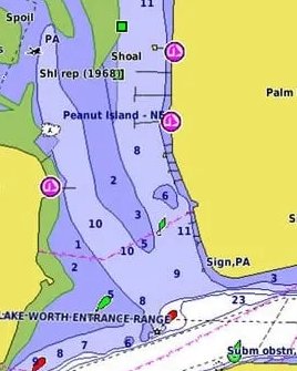
This ECHOMAP Plus combo features preloaded BlueChart g3 charts with integrated Navionics data, covering the coastal U.S. (east coast, west coast, Gulf of Mexico, U.S. and the Canadian side of the Great Lakes). Data is derived from official charts and private sources to provide navigational aids, spot soundings, depth contour, tides and currents and more. |
|
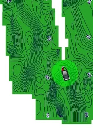
Instantly create personalized fishing maps on-screen with 1’ contours as you fish. Tailor them to fit your needs. These are your maps — you own them. Keep the data to yourself, or share it with the Quickdraw Community on Garmin Connect.™. |
|
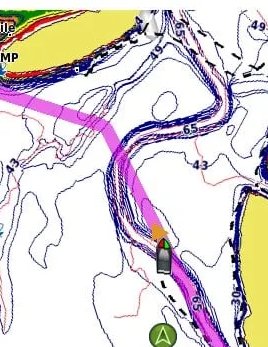
Step up to LakeVü g3 Ultra freshwater maps featuring Garmin Elite survey lakes, or select BlueChart® g3 or premium BlueChart® g3 Vision2 coastal charts, all with integrated Navionics data, Auto Guidance1 technology and other great features. A single microSD™ card slot provides expandable memory for accessory map purchases. |
|
Take Your ECHOMAP Plus with You When you’re off the water, it’s easy to keep your ECHOMAP Plus combo safe and secure. You don’t have to mess with plugging and unplugging wires from the unit because the cords plug directly into the mount. This allows you to quickly install and remove your ECHOMAP Plus from power and the mount. |